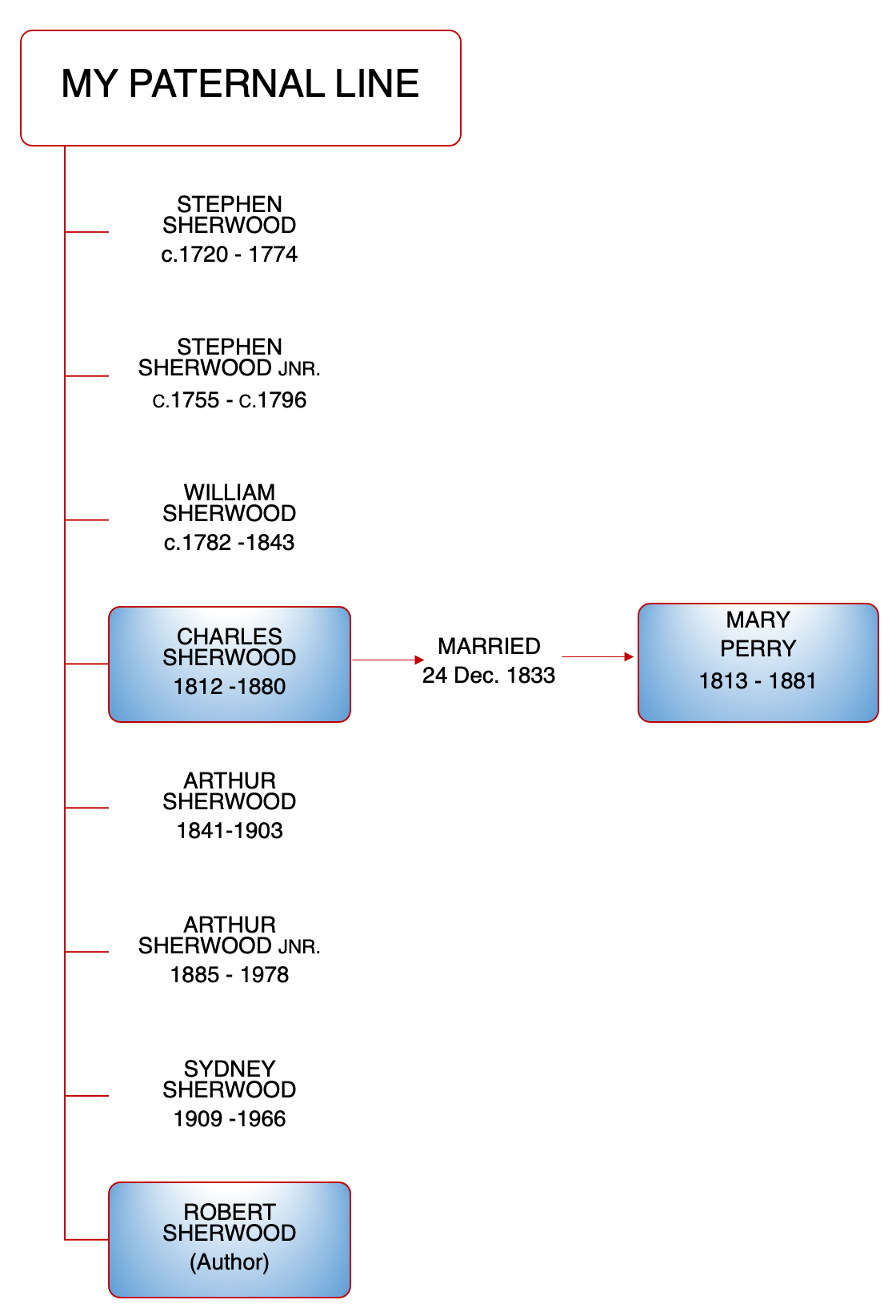
The diagram shows the authors relationship to Charles and Mary Sherwood
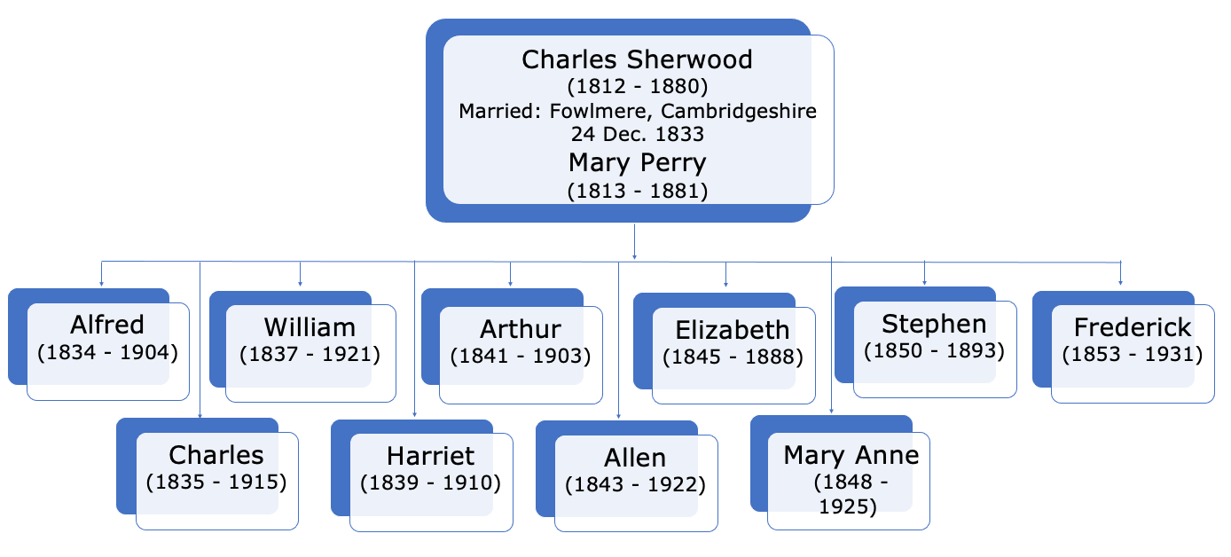
The Family of Charles and Mary Sherwood nee Perry
THE SETTING
The small English village of Fowlmere, Cambridgeshire
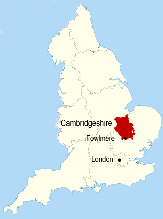
Map showing the location of Fowlmere, Cambridgeshire
Fowlmere, Cambridgeshire
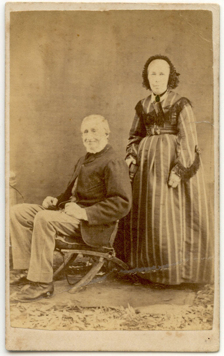
Charles and Mary Sherwood nee Perry c.1864
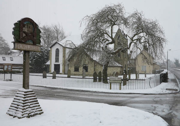
The Village of Fowlmere, Cambridgeshire. Photographed: 2000
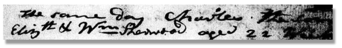
Baptism entry. Charles the son of Elizth & Wm Sherwood.
Transcript
The same day Charles the son of Elizth. & Wm Sherwood aged 22 weeks
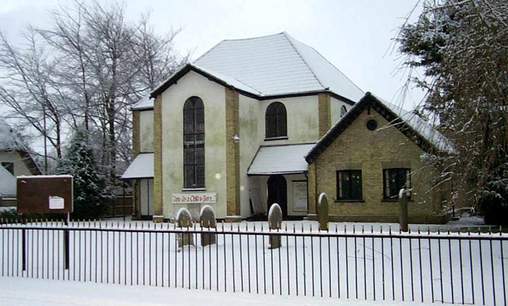
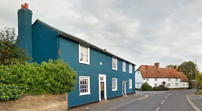
Fowlmere Independent Chapel (white facade) Photographed: 2000
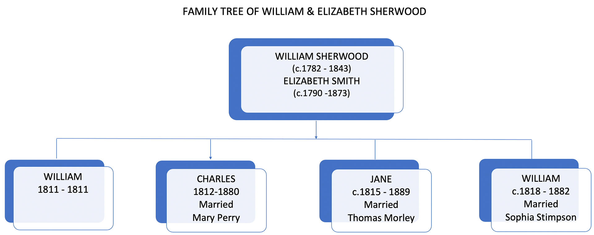
Charles' parents and siblings
Mary was a week or so shy of five months old. The baptism was performed by John Dawson Wrigglesworth, a visiting curate to the parish.
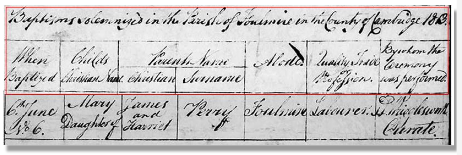
Baptism entry for Mary daughter of James and Harriet Perry
Transcript
6 June (1813) Mary daughter of James and Harriet Perry, Foulmire. Labourer. J.Wrigglesworth, Curate.
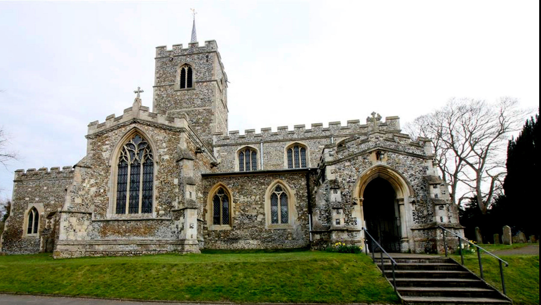
Saint Mary's Church, Fowlmere, Cambridgeshire. Photographer: R J Sherwood 2013
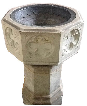
Baptism Font, Saint Mary’s church, Fowlmere. Photographer: R J Sherwood.
Then there were those representing the Sherwood family who were present. Charles' parents William and Elizabeth Sherwood and his grandmother Elizabeth Sherwood, later Dixon (c.1760-1850). The twice-widowed Elizabeth was living with her son William Sherwood in Fowlmere in 1841. She was most likely living in the village much earlier than this date. No doubt Charles' sister Jane and her husband Thomas Morley and Charles’ younger brother William were also present at their older brother’s marriage.
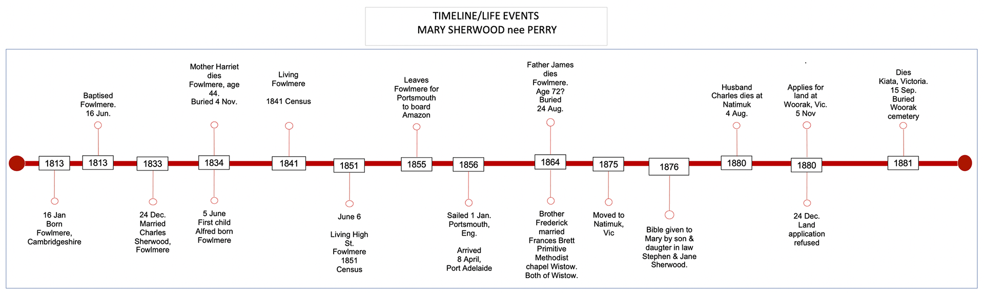
Timeline: Mary Sherwood, nee Perry.
The Rose Inn, High Street Melbourn, Cambridgeshire. 2019
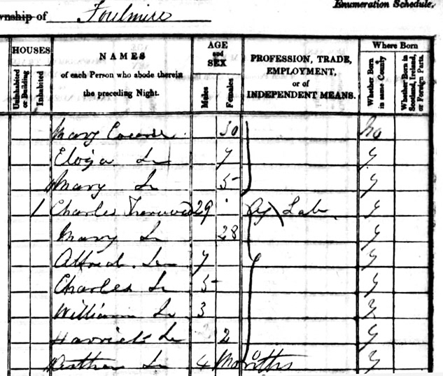
1841 Fowlmere Census
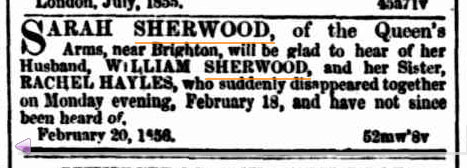
Sarah's Sherwood
Transcript: SARAH SHERWOOD, of the Queen's Arms, near Brighton, will be glad to hear of her Husband, WILLIAM SHERWOOD, and her Sister, RACHEL HAYLES, who suddenly disappeared together on Monday evening, February 18, and have not since been heard of. February 20, 1856.
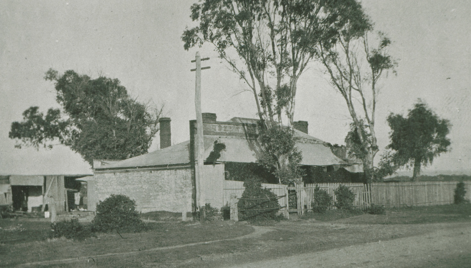
Queens Arms. Photographed 1900.
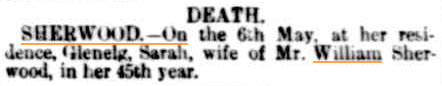
Death notice Sarah Sherwood
SHERWOOD. On the 6th May, at her residence, Glenelg, Sarah, wife of
Mr. William Sherwood, in her 45th year.
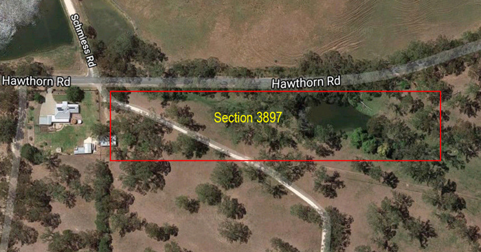
Satellite image of Section 3897, Bugle Ranges
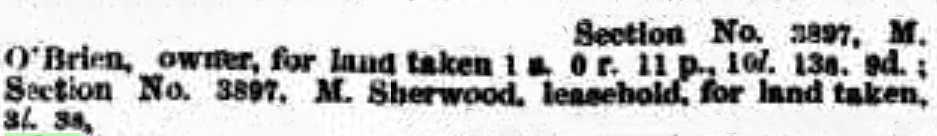
M. Sherwood, leasehold section 3897
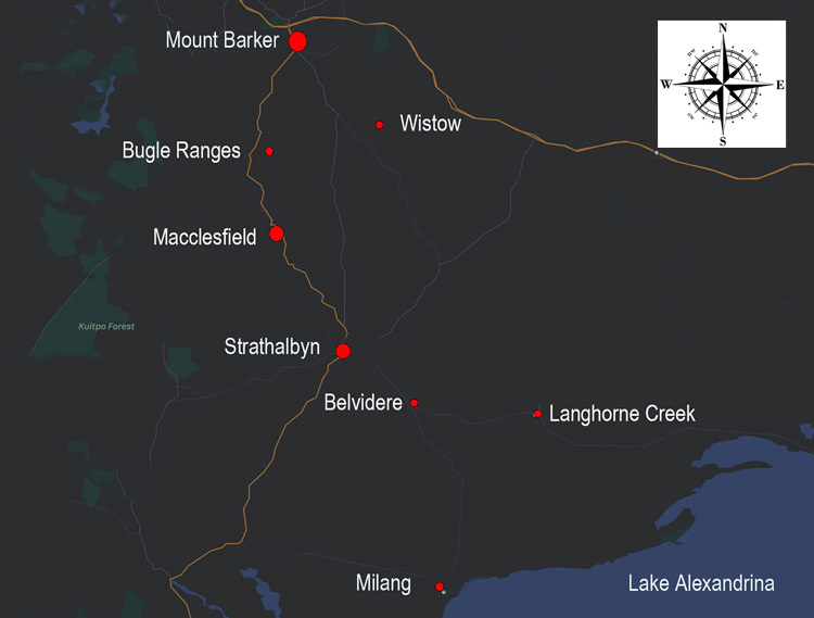
Map showing the districts of Wistow and Bugle Ranges
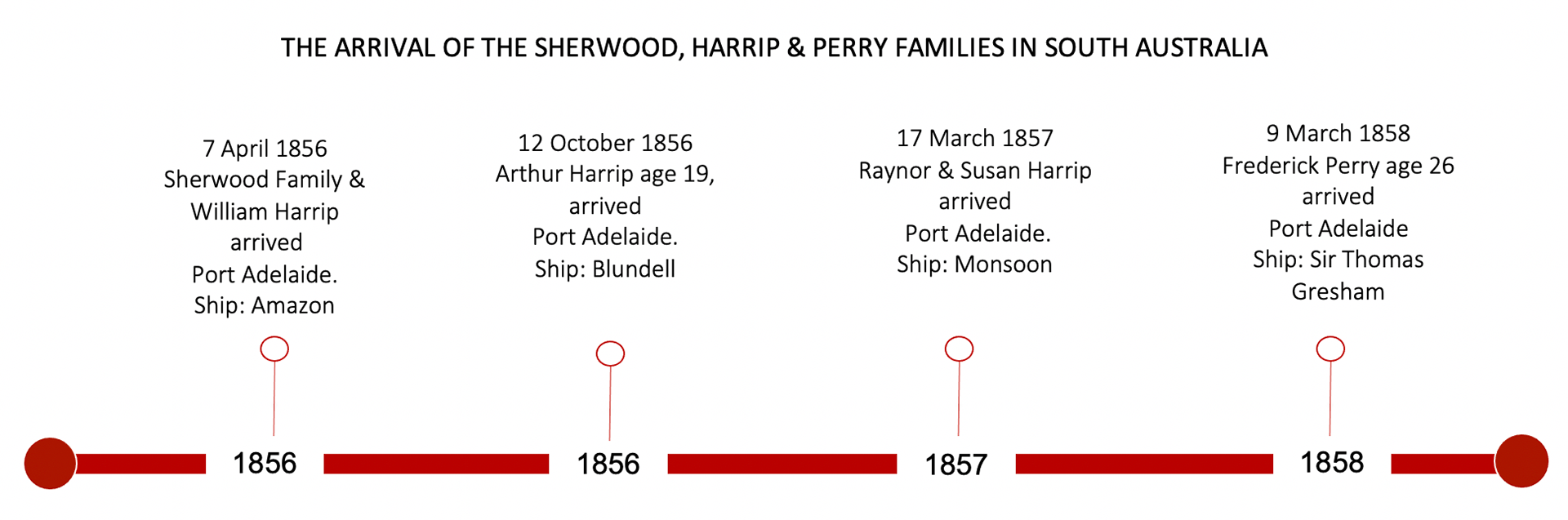
Timeline showing the arrival of other family members.
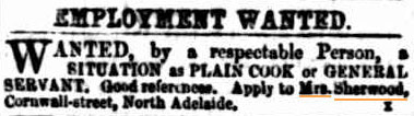
September 1860. Elizabeth's advertisement for work .
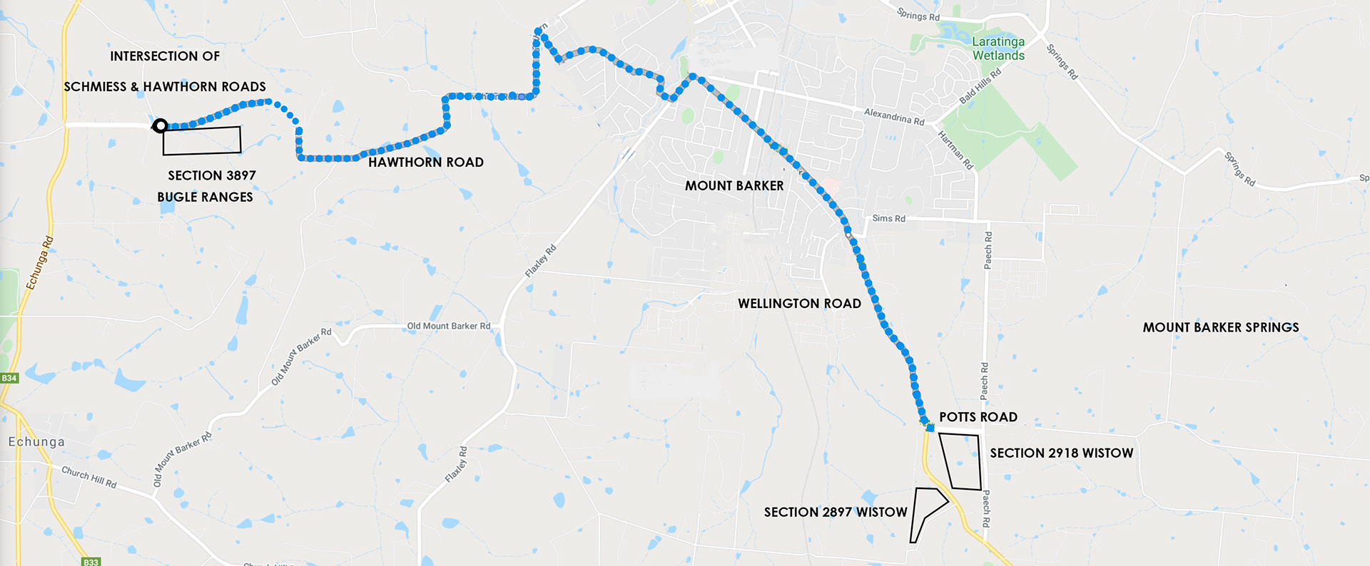
Map shows land leased by Charles & Mary. At Bugle Ranges and Wistow.
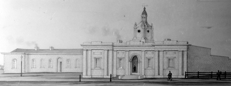
Local Court and Police Court King William Street Adelaide. 1851-1854.
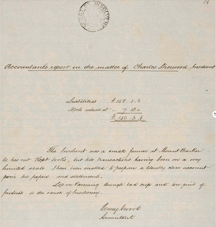
Accountant's report in the matter of Charles Sherwood, Insolvent.

Neglect of Elizabeth Sherwood 6 June 1873.
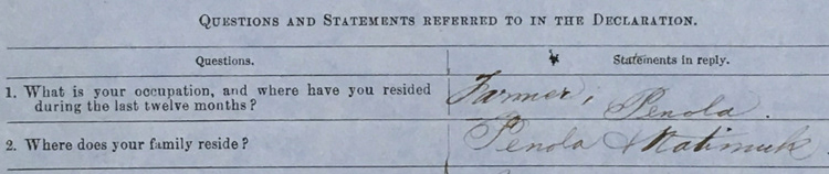
Part of Charles Sr. application for land at Natimuk, Vic. 7 August 1875
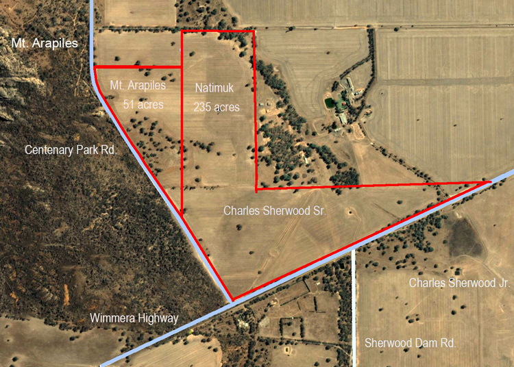
Charles Sherwood Sr. selection at Natimuk, Victoria
His son Charles' property is shown at the bottom, right of the map.
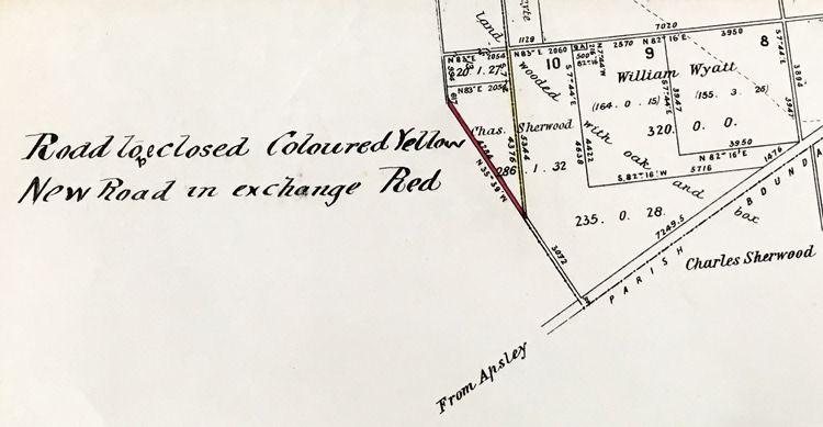
Map shows the road running through Charles' selection
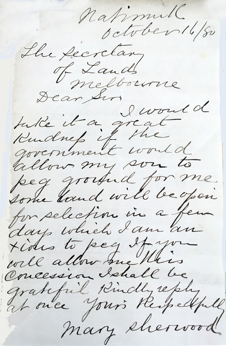
Mary's letter to the Secretary
of Lands, Melbourne.
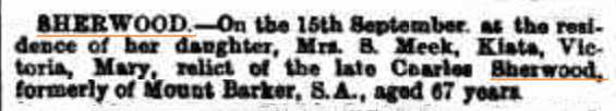
Mary Sherwood's obituary notice, 1881
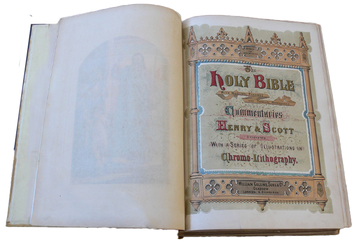
Mary Sherwood's Bible
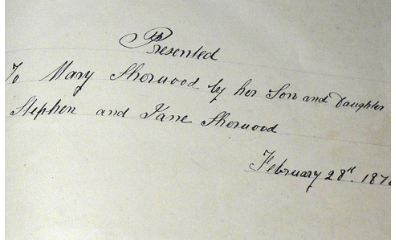
Inscription on the first page of Mary Sherwood’s Bible.
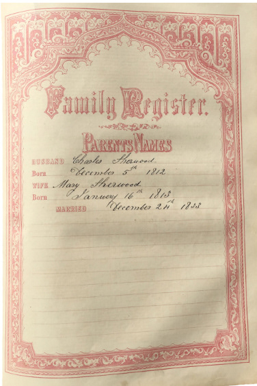
Parent’s Names.
Husband: Charles Sherwood. Born: December 5th 1812
Wife: Mary Sherwood Born: January 16th 1813
Married: December 24th 1833